

BERKELEY COUNTY, S.C.–Berkeley County and the surrounding counties may experience snow and sleet this week, according to the National Weather Service.
A Winter Storm Watch will be in effect from Wednesday morning to Wednesday evening.
[VIEW THE CURRENT LOCAL TEMPERATURE HERE]
This means some accumulations of snow and/or ice are possible as a storm system passes offshore.
A chance of snow and sleet may occur before 8 a.m., then a chance of snow may occur between 8 a.m. and 9 a.m., then snow and sleet likely after 9 a.m, according to NWS.
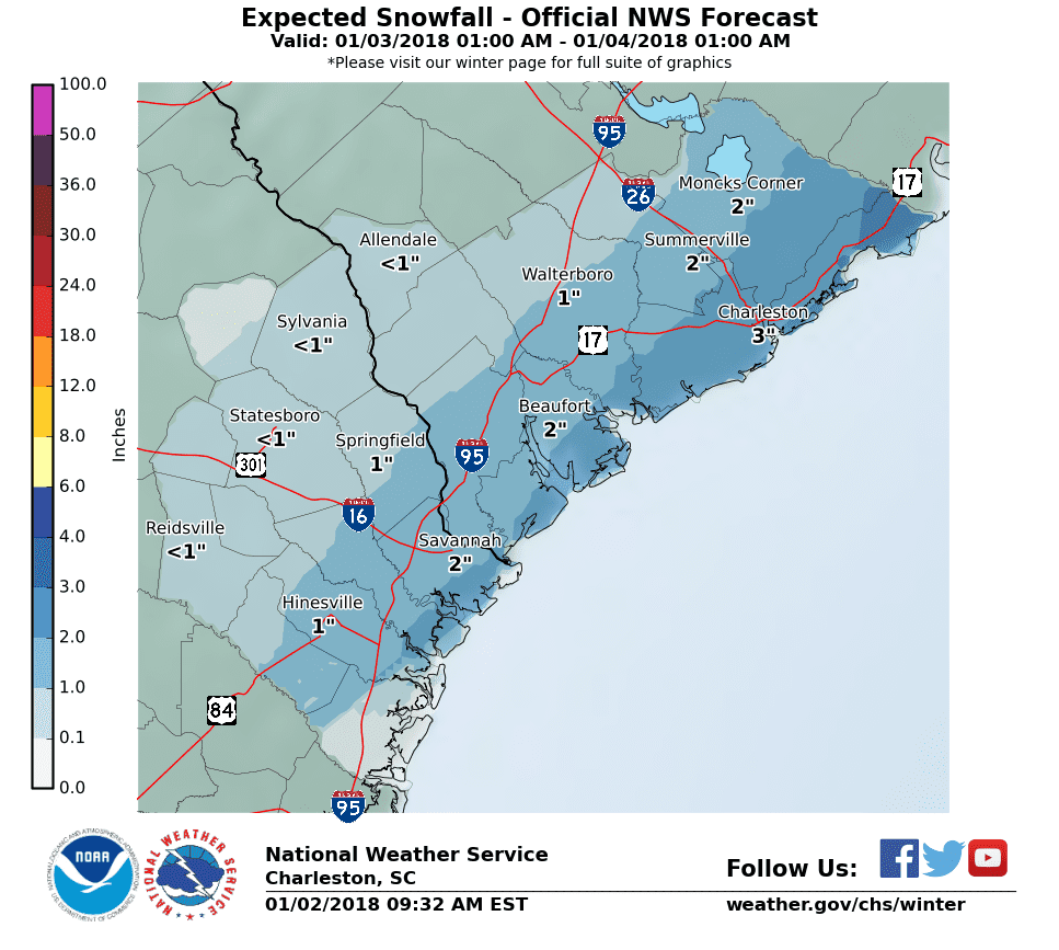
Snow will be likely before 10 p.m., then a slight chance of freezing rain between 10 p.m. and 11 p.m.
Wednesday’s forecast is predicted to be cloudy with a high near 36 and low of 23. A chance of precipitation is 70%.
[VIEW WARMING SHELTERS IN BERKELEY COUNTY]
New snow and sleet accumulation of 1 to 2 inches possible.
The combination of temperatures and winds will likely lead to wind chills near 15 degrees each morning through Saturday. Thus, Wind Chill Advisories may be possible.
- Nearly Century-Old St. Stephen School To Be Torn Down - March 20, 2024
- BCSD Approves $10K Bonus For Special Education Teachers - March 19, 2024
- WakeUp Carolina Celebrates Moncks Corner Grand Opening With Ribbon Cutting - March 12, 2024


Recent Comments