Hurricane Matthew is expected to move north from the Bahamas later this week, possibly bringing significant impacts to southeast South Carolina and southeast Georgia.
Strong high pressure wedging remains in place as of Wednesday morning. Isolated showers are expected to remain offshore, but similar to the past few days, the onshore flow could still bring a few of these across mainly coastal Georgia.
Breezy conditions will persist at the beaches with winds 20-25 mph with higher gusts. A thin layer of moisture trapped beneath the wedge inversion has produced a widespread stratus deck.
The deck will be slow to rise with guidance really only showing far inland interior Georgia breaking out during max heating. Adjusted sky cover grids to reflect this and also nudged highs down a degree or so for most locations.
This lowering may not be aggressive enough, especially northern parts of the CWFA, so trends will be monitored for additional adjustments.
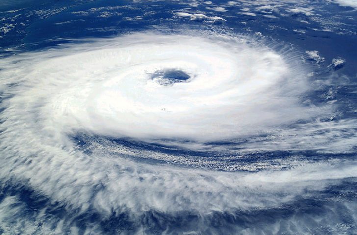
When a hurricane is forecast to take a track roughly parallel to a coastline, as Matthew is forecast to do from Florida through South Carolina, it becomes very difficult to estimate this far in advance.
For example, only a small deviation of the track to the left of the NHC forecast could bring the core of a major hurricane onshore, while a small deviation to the right could keep all of the hurricane-force winds offshore.
It will likely take another day or so for the potential impacts of Matthew in the United States to clarify.
While there is still some uncertainty in the track/strength of Matthew, folks across southeast SC/GA should prepare for sustained hurricane-force winds /74+ mph/, coastal flooding, heavy rainfall-induced freshwater flooding and isolated tornadoes, especially near the coast.
There is also the potential for the center of Matthew to cross the coast and this would increase the coastal flooding due to a potentially significant storm surge, mainly to the north and east of the landfall location.


