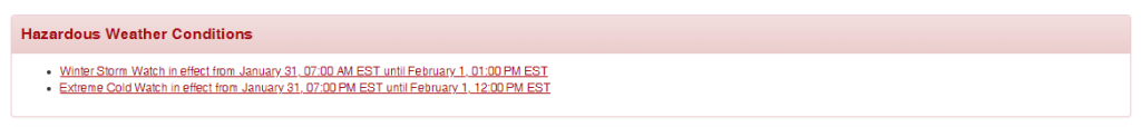
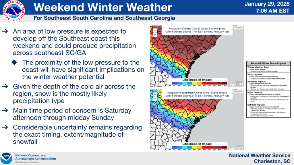
BERKELEY COUNTY, S.C. – The National Weather Service has issued a Winter Storm Watch and an Extreme Cold Watch for Berkeley County, both set to begin Saturday, Jan. 31, as forecasters continue to monitor the potential for snow and very cold temperatures this weekend.
According to the National Weather Service in Charleston, the Winter Storm Watch will be in effect from 7 a.m. Saturday through 1 p.m. Sunday, with snow accumulations between 1 and 4 inches possible across portions of Berkeley County, including Moncks Corner, Goose Creek and surrounding inland and tidal areas.
Weather conditions are expected to begin deteriorating late Friday night. Forecasters call for a 20 percent chance of rain after 1 a.m., with mostly cloudy skies and overnight lows around 32 degrees. Winds are expected to remain calm early, becoming northerly around 5 mph after midnight.
📣 STAY IN THE LOOP 📣
📰 Sign Up for Berkeley County, SC Newsletter ⬅️
On Saturday, precipitation is expected to increase, with snow possibly mixed with rain during the day before transitioning to all snow after 4 p.m. High temperatures are forecast near 40 degrees, with north winds between 6 and 11 mph and gusts up to 24 mph. The chance of precipitation is 80 percent, and new snow accumulation of less than one inch is possible during the day.
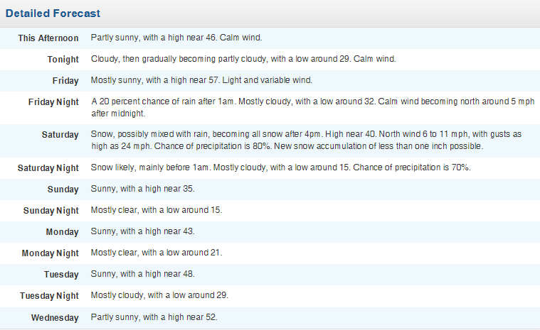
Conditions are expected to turn significantly colder Saturday night, with snow likely before 1 a.m., followed by mostly cloudy skies and overnight lows around 15 degrees. Forecasters place the chance of precipitation at 70 percent during the evening hours.
By Sunday, skies are expected to clear, with sunny conditions and a high near 35 degrees, though cold temperatures will persist.
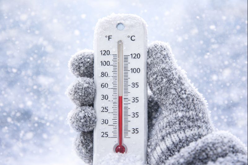
In addition to the snow threat, the National Weather Service has issued an Extreme Cold Watch from 7 p.m. Saturday through 7 a.m. Sunday, warning that wind chill values could fall into the single digits across Berkeley County.
Officials advise residents to use caution if traveling, particularly during periods of snow or freezing temperatures. Residents are also encouraged to protect exposed pipes, check on elderly neighbors and family members, and ensure space heaters are used properly. The Weather Service cautions against using grills or generators indoors due to the risk of carbon monoxide poisoning.
Forecasters say the forecast could continue to evolve and encourage residents to monitor updated forecasts and potential warnings as the weekend approaches.


